
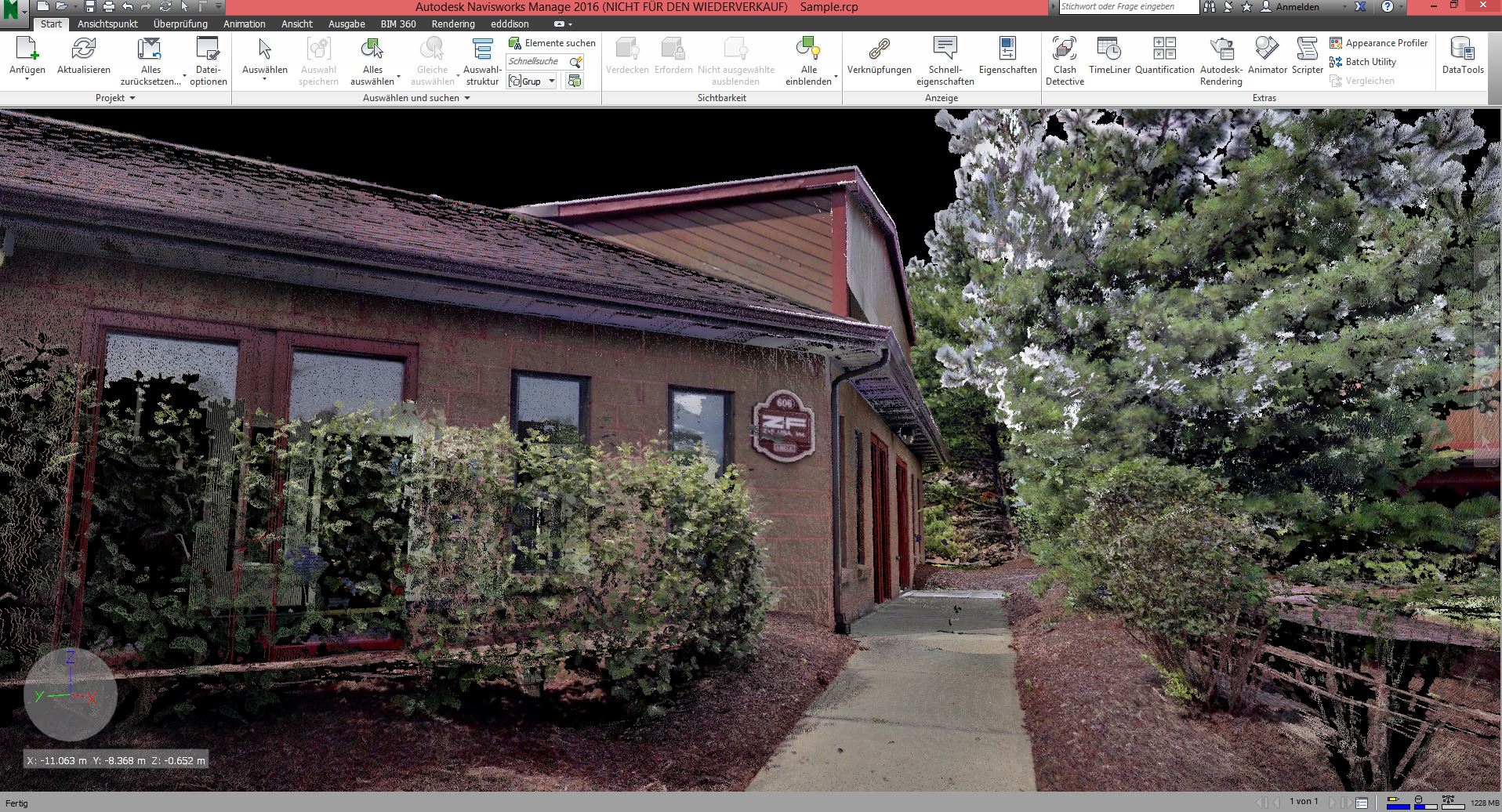
A point cloud is a set of data points in a three-dimensional coordinate system. These points tend to represent the external surface of an object.
edddison helps the user to navigate in this point cloud in an easy and comforting way. You are controlling your position in a floorplan, so no fear to get lost.
Download edddison Navisworks point cloud demo
Thanks ZF-USA for providing the data.
Let me explain how i did:
1: Import the point cloud to Navisworks
Extensions such as .pts, .3dd , .asc .txt, .zfc .zfs, .fls .fws, .rcs .rcp are supported.
2: Connect to edddison, which will appear in the toolbar once installed
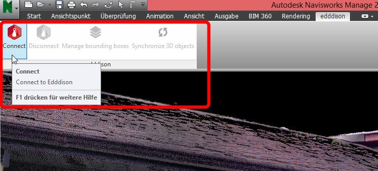
For detailed Information on how to setup edddison please visit the Tutorials section
3: Create a bounding box for the area in which you want to walk around
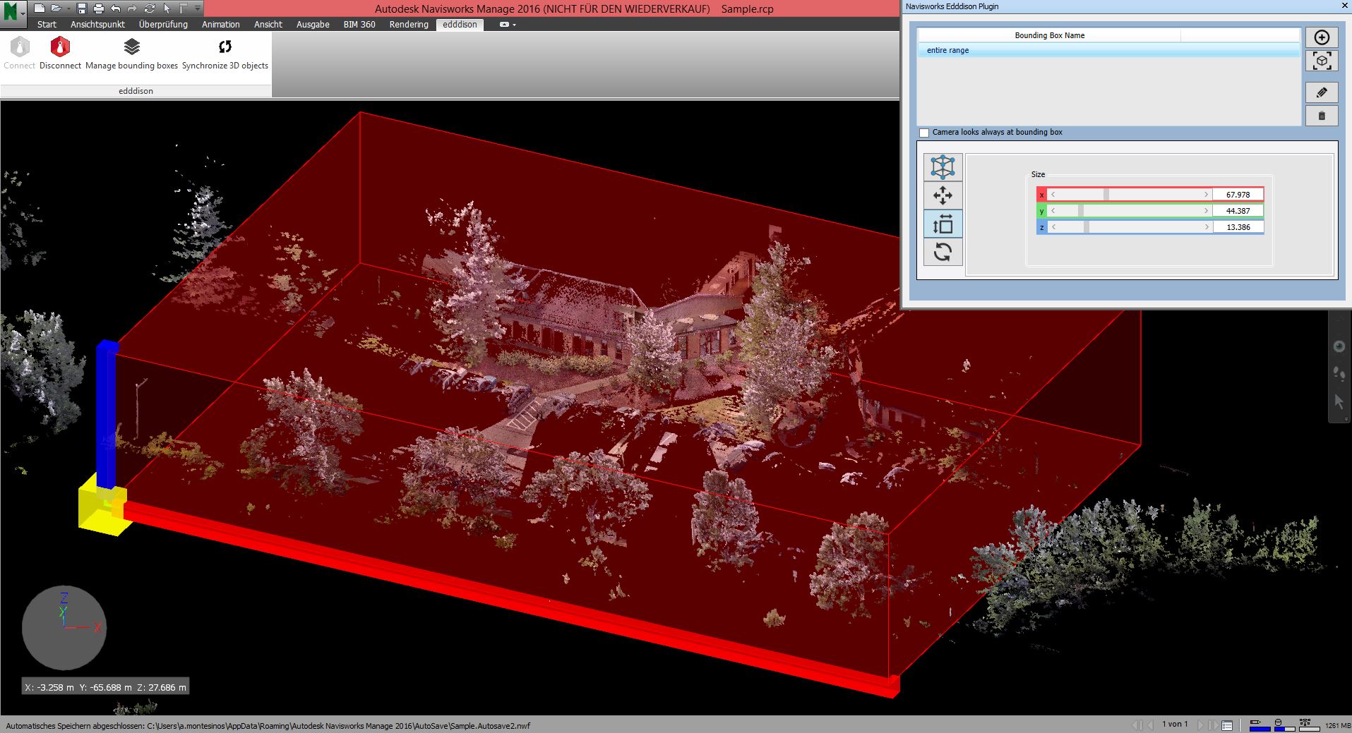
4: Once this bounding box is linked and you created our “Point of View”, you are ready to interact with the Point Cloud data
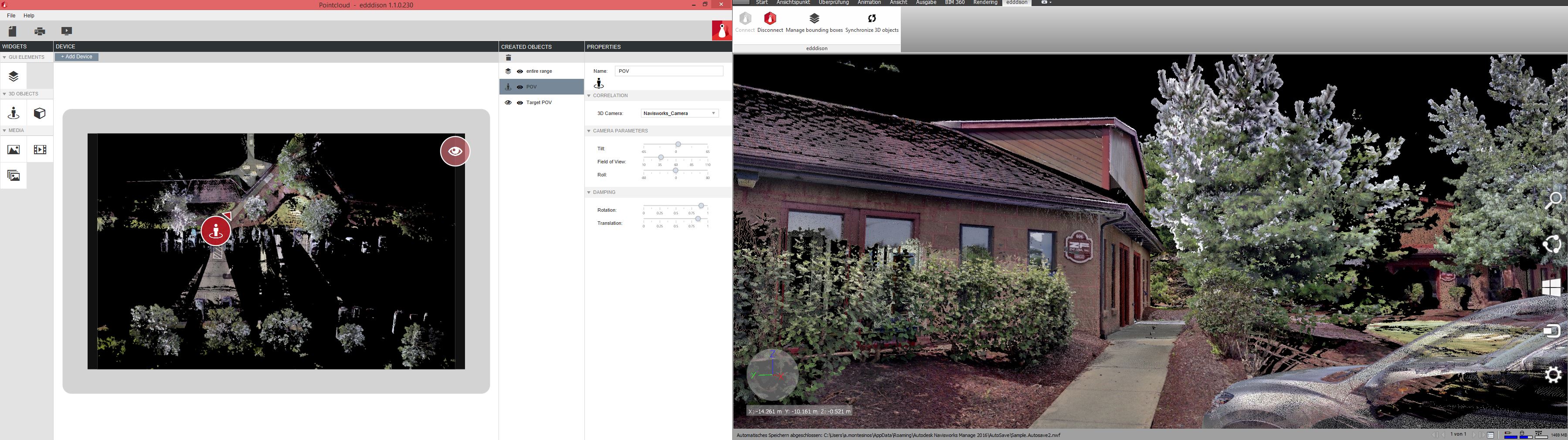
5: Interact by using the edddison editor, a tablet or tangible object. For more information about the possibilities watch a video
Autodesk Navisworks is a great software that permits to work in an efficient way with large files. Navisworks Features enable coordination, construction simulation, and project analysis for integrated project review. With a Point Cloud the user has got the complete control of every single part of the project. And with edddison to extend the accessibility and intuitive interaction nothing can go wrong anymore.
To sum up:
Navisworks permits to navigate around the 3d model; however edddison tool makes the navigation quicker, smoother, and in every moment you know where you are.
Written by José Alberto Simón Montesinos
Find out more in the edddison Documentation